August 19th, 2019
Alerts
No Alerts at this time
Storm Updates
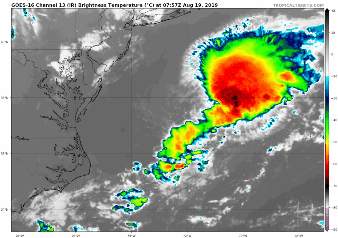
Tropical Update: We are tracking Invest 97-L off the Carolina coast tracking North East heading far offshore, winds are currently at 55.5km/h and over last several hours this morning, thunderstorm activity has increased and there is a slight chance of this storm developing significantly through out today and possibly become a Tropical Depression or Tropical Storm. If it becomes a storm with winds of 64km/h, then the next letter is C "Chantal" the 3rd name in the 2019 hurricane season.
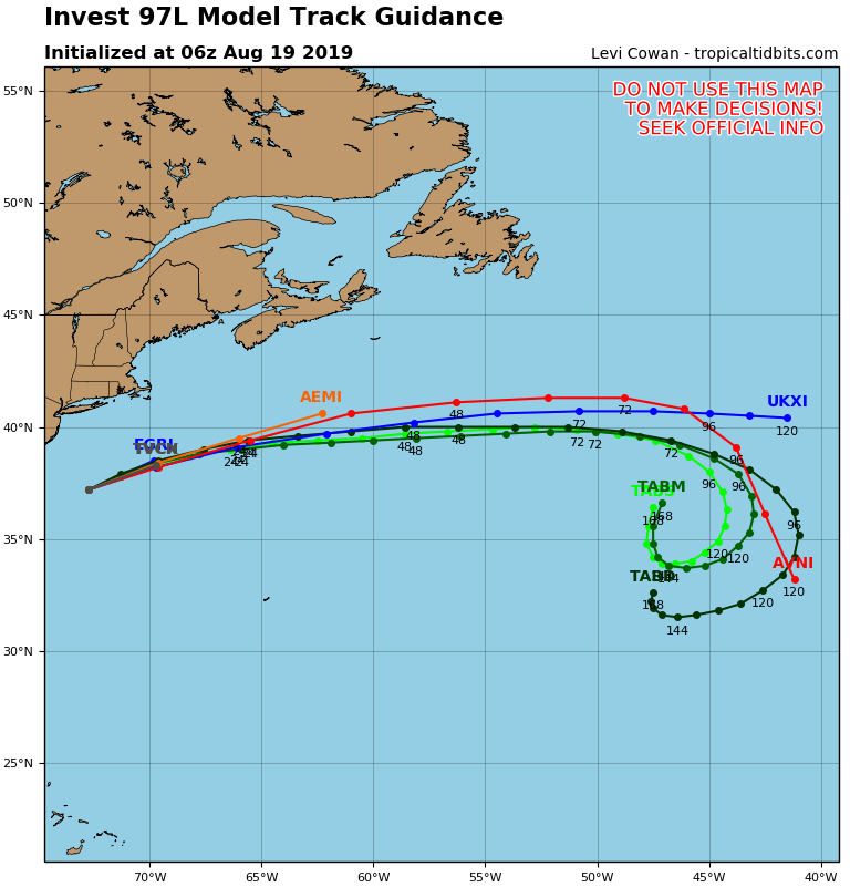
At this point there is no indication this storm will impact us here at home in Newfoundland, a High pressure South of us and over Nova Scotia will help continue to steer this storm to the North East then Eastward over 48 hours, keeping it far offshore to the south of us.
Any impact at all from this will likely be some small increased waves over next 48-72 hours.
Storm Maps